Home


English
Access your basket

 ::  Homepage  ::  List of features  :: 
Search ok
 ::  Contacts  ::  Help for professionals  :: 


 ::  Print the picture  ::  All Features  :: 
Add picture to basket


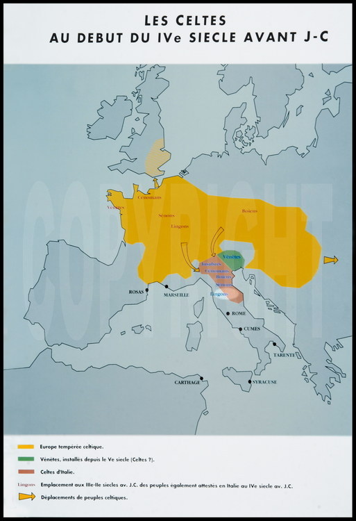
Map of the Celtic territory in the early 4th century BCE. The lighter areas indicate the archeological digs conducted in the Apennins Mountains and led by Italian archeologist Daniele Vitali, located where the ancient Celts and Etruscan populations cohabited.
© Stéphane Compoint
20030901-029
Map of the Celtic territory in the early 4th century BCE. The lighter areas indicate the archeological digs conducted in the Apennins Mountains and led by Italian archeologist Daniele Vitali, located where the ancient Celts and Etruscan populations cohabited.

     ::  Order this picture  :: 
Name*   Message :
Email* 
I have read and accept your Terms of use
I accept to be registered to your mailing list to be informed about your website news
Your order comes from:
from France
from abroad
* Needs fields OK
If you order more than one photo, please send only one email with the reference of each picture


:: Stéphane Compoint - 9 rue de la Vistule 75013 Paris France - Tel : +33 6 08 75 75 57 - email : sc@stephanecompoint.com ::
:: All rights reserved - www.stephanecompoint.com - This web site is for a professional use only ::
:: Login - © 2005 © 2012 - Realisation: Anakrome & iota ::